No products
Prices are tax included
Product successfully added to your shopping cart
There are 0 items in your cart. There is 1 item in your cart.
Archéologie du Paysage
- Archéologie et Histoire Romaine
- Archéologie Moderne et Contemporaine
- Archéologie des Plantes et des Animaux
- Archéologie du Paysage
- Archives & Histoire de l'Archéologie
- Europe Médiévale
- Monographies Instrumentum
- Préhistoires
- Protohistoire européenne
- Research Protocols
- Off collections
- Les cahiers de saint-michel de Cuxa
- Second-hand
 View larger
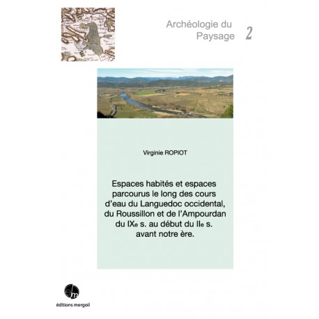
 Espaces habités et espaces parcourus le long des cours d'eau du Languedoc occidental.
AP-02
New
Virginie ROPIOT - Espaces habités et espaces parcourus le long des cours d'eau du Languedoc occidental, du Roussillon et de l'Ampourdan du IXe s. au début du IIe s. avant notre ère. Préf. A. Daubigney, 2015, 431 p., 152 ill. (ISBN : 978-2-35518-050-7)
Cet ouvrage pose la question des liens entre le réseau hydrographique, l’occupation humaine et les voies de communication de l’Hérault (Languedoc occidental) au Ter (Ampourdan), du Bronze final IIIb à la veille de la conquête romaine (IXe - début du IIe s. av. n. è.). Cette perspective requiert une démarche où se confrontent les spécificités géographiques des bassins fluviaux, la répartition des implantations riveraines et la diffusion des produits des échanges. La relation entre le chenal fluvial, le peuplement et les réseaux commerciaux est donc envisagée comme un fil conducteur.
Warning: Last items in stock!
More info
This book reflects on the links between hydrographic systems, human occupations and communication network, from the Hérault river (western Languedoc) to the Ter (Ampurdan), between the end of the Bronze Age (Bronze Final IIIb) and the Roman conquest (9th - beginning of the 2nd c. BC). This research uses a methodology which compares the geographical specificities of the river basins, the presence of the nearby settlements and products distribution. The relation between the river chanels, the settlements and the trading network is therefore used as the main framework. The observations about the occupation layout reveal numerous fluctuations. Several nuanced sequences and breakdowns contradict a development that would be both linear and gradual. Constancies are witnessing real settlement strategies in which the relationship between humans and rivers is the main component. On the subject of the communication network and trading, the environmental aspect of the sites is particularly important, as they open up onto valleys and communication routes, revealing an organisation directly linked with the organisation of exchanges. There, the correlation between the dynamic of the traffic routes and the web of inhabitations appears primordial. In a way, in a well organised exchange network, the river valleys, alongside which the sites are located, create a very structuring base for the development of settlement. Therefore, from the Hérault to the Ter, rivers appear as the major element conditioning the inhabited and travelled space.
Préface d'Alain Daubigney et Avant propos
Introduction
I) ETAT DES LIEUX GEOGRAPHIQUE ET HISTORIOGRAPHIQUE DU PAYSAGE FLUVIAL DE L'HERAULT AU TER
II) LA QUESTION DU RAPPORT A L'EAU
III) LA DYNAMIQUE DU PEUPLEMENT DANS LES BASSINS FLUVIAUX
IV) TRAFICS COMMERCIAUX ET RESEAUX D'ECHANGES
V) CONDITIONS ET ITINERAIRES DE DEPLACEMENTS
Conclusion
Bibliographie
Annexes


